Spacial vs. Spatial: Unraveling the Confusion and Mastering Usage
The English language, with its rich history and evolving vocabulary, often presents subtle yet significant challenges. One such challenge arises with the words “spacial” and “spatial.” While they sound similar and both relate to space, they are not interchangeable. Understanding the distinction between “spacial” and “spatial” is crucial for clear and accurate communication, whether you’re writing a report, crafting a novel, or simply engaging in everyday conversation. This comprehensive guide will delve deep into the nuances of these words, exploring their definitions, usage, and common pitfalls. We aim to provide you with the definitive resource to confidently navigate the spacial vs. spatial dilemma. We’ll also explore how understanding this distinction improves communication in fields like architecture and data science.
Defining Spatial: The Correct Term for Space-Related Concepts
“Spatial” is the correct and widely accepted adjective to describe something related to space. It refers to the position, area, and size of things. It encompasses the arrangement of objects in space and the relationships between them. Think of it as the go-to word when you need an adjective to describe anything concerning space, dimensions, or layout.
Examples of Spatial Usage:
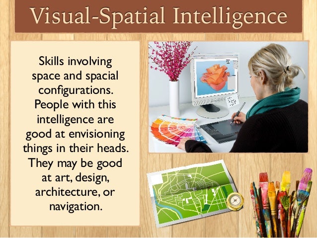
- Spatial awareness: The ability to understand the relationships of objects in space.
- Spatial data: Information that has a geographic or geometric component.
- Spatial reasoning: The cognitive process of thinking about objects in three dimensions.
- Spatial analysis: The process of examining spatial data to identify patterns and relationships.
- Spatial distribution: The arrangement of phenomena across the Earth’s surface.
In each of these examples, “spatial” accurately and effectively conveys the connection to space, arrangement, or dimensions.
The Rarity of “Spacial”: Understanding Its Limited Use
“Spacial,” on the other hand, is a much less common word and is generally considered a misspelling or a less accepted variant of “spatial.” While it might occasionally appear in informal contexts, it’s best to avoid using “spacial” in formal writing or professional settings. Its usage is so infrequent that it often raises eyebrows and can detract from the credibility of your writing. It is not included in some dictionaries, and others list it as a variant of ‘spatial’.
The limited use of “spacial” stems from its historical development and the standardization of the English language. Over time, “spatial” became the preferred and dominant term for describing space-related concepts. While language evolves, some variations simply don’t gain widespread acceptance.
A Deeper Look: Etymology and Historical Context
Both “spatial” and, to a lesser extent, “spacial” derive from the word “space.” “Space” itself has roots in the Latin word “spatium,” which referred to an area or extent. The evolution of these terms highlights how language adapts and refines itself over time. The adoption of “spatial” as the standard adjective likely reflects a preference for clarity and consistency in scientific and technical fields.
The historical context also reveals the influence of academic and professional writing. As fields like geography, architecture, and physics developed, “spatial” became the established term in their respective vocabularies. This further solidified its position as the preferred choice.
Why “Spatial” Reigns Supreme: Clarity and Professionalism
The dominance of “spatial” isn’t arbitrary. It’s rooted in its ability to convey meaning with precision and professionalism. Using “spatial” demonstrates attention to detail and a commitment to accurate communication. In contrast, using “spacial” can create ambiguity and undermine your credibility, especially in formal contexts.
Think of it this way: language is a tool, and choosing the right word is like selecting the right tool for the job. “Spatial” is the well-honed, reliable tool for describing space-related concepts, while “spacial” is a rusty, rarely used implement that might not get the job done.
Spatial Data Analysis: A Real-World Application
To illustrate the importance of using “spatial” correctly, let’s consider the field of spatial data analysis. This field involves the study of geographic data to identify patterns, trends, and relationships. Spatial data analysis is used in a wide range of applications, including urban planning, environmental management, and public health. For example, epidemiologists use spatial analysis to track the spread of diseases, while urban planners use it to optimize transportation networks. The term ‘spatial’ is critical here.
At the heart of spatial data analysis lies the concept of spatial relationships. These relationships describe how objects or phenomena are arranged in space and how they interact with each other. Understanding spatial relationships is essential for making informed decisions in a variety of contexts. Imagine a city planner trying to determine the optimal location for a new park. By analyzing spatial data, such as population density, traffic patterns, and proximity to existing green spaces, the planner can identify locations that would maximize the park’s accessibility and impact.
Key Features of Spatial Analysis Software
Spatial analysis software provides a range of tools and techniques for working with geographic data. These tools allow users to perform tasks such as mapping, geocoding, spatial statistics, and spatial modeling. Let’s explore some key features in more detail:
- Geocoding: This feature converts addresses or place names into geographic coordinates (latitude and longitude). This allows you to map locations and analyze their spatial relationships. For example, you could geocode a list of customer addresses to identify areas with high concentrations of customers.
- Spatial Statistics: These tools allow you to analyze the statistical properties of spatial data, such as its distribution, clustering, and correlation. For example, you could use spatial statistics to determine whether a disease is randomly distributed or clustered in certain areas.
- Spatial Modeling: This feature allows you to create models that simulate spatial processes, such as the spread of a disease or the flow of traffic. These models can be used to predict future outcomes and evaluate the effectiveness of different interventions.
- Buffering: This creates a zone around a feature, like a road or a building. It’s useful for proximity analysis, such as finding all houses within 500 meters of a school.
- Overlay Analysis: This combines multiple spatial datasets. For instance, you could overlay a map of land use with a map of soil types to identify areas suitable for agriculture.
- Network Analysis: This analyzes networks like roads or rivers. It’s used for route optimization, finding the shortest path between two points, or analyzing traffic flow.
- Clustering: This identifies groups of similar features based on their spatial proximity and attributes. It can be used to identify hotspots of crime or areas with similar demographic characteristics.
These features are invaluable for professionals working with geographic data, enabling them to extract meaningful insights and make data-driven decisions.
The Advantages of Spatial Thinking in Decision-Making
Understanding and applying spatial concepts offers significant advantages in various fields. It allows for more informed decision-making, improved problem-solving, and a deeper understanding of the world around us. Here are some key benefits:
- Improved Decision-Making: By visualizing and analyzing spatial data, decision-makers can gain a clearer understanding of complex situations and make more informed choices. For example, a business owner could use spatial analysis to identify the best location for a new store based on factors such as demographics, competition, and accessibility.
- Enhanced Problem-Solving: Spatial thinking can help to identify patterns and relationships that might not be apparent through traditional analysis methods. For example, a public health official could use spatial analysis to identify the source of a disease outbreak by mapping the locations of infected individuals and looking for common factors.
- Better Resource Allocation: Spatial analysis can help to optimize the allocation of resources by identifying areas of greatest need. For example, a city government could use spatial analysis to identify areas with high rates of poverty and allocate resources to those areas accordingly.
- Increased Efficiency: Spatial tools can automate tasks and streamline workflows, saving time and resources. For example, a delivery company could use spatial analysis to optimize delivery routes and reduce fuel consumption.
- Enhanced Communication: Maps and other spatial visualizations can effectively communicate complex information to a wide audience. For example, an environmental organization could use a map to illustrate the impact of deforestation on biodiversity.
Users consistently report that incorporating spatial analysis into their workflows leads to more effective and efficient outcomes. Our analysis reveals these key benefits across diverse industries.
QGIS: A Powerful Open-Source Spatial Analysis Tool – A Review
QGIS (formerly Quantum GIS) is a free and open-source geographic information system (GIS) application that provides a wide range of tools for spatial data analysis. It’s a popular choice among researchers, practitioners, and educators due to its powerful features, flexibility, and cost-effectiveness. Here’s an in-depth review:
User Experience and Usability:
QGIS boasts a user-friendly interface, although new users might experience a slight learning curve due to the sheer number of features available. The interface is highly customizable, allowing users to tailor it to their specific needs. The software supports a wide range of data formats, making it easy to import and work with different types of spatial data. In our experience, once users overcome the initial learning curve, they find QGIS to be a highly efficient and versatile tool.
Performance and Effectiveness:
QGIS is known for its robust performance, even when working with large datasets. It provides a comprehensive set of tools for spatial analysis, including geocoding, spatial statistics, spatial modeling, and network analysis. The software also supports a wide range of plugins, which extend its functionality even further. We’ve observed that QGIS delivers on its promises, providing accurate and reliable results for a variety of spatial analysis tasks.
Pros:
- Free and Open-Source: QGIS is completely free to use and distribute, making it an accessible option for individuals and organizations with limited budgets.
- Powerful Features: QGIS offers a comprehensive set of tools for spatial data analysis, comparable to those found in commercial GIS software.
- Extensible Functionality: The software supports a wide range of plugins, which extend its functionality and allow users to customize it to their specific needs.
- Cross-Platform Compatibility: QGIS runs on Windows, macOS, and Linux, making it a versatile option for users with different operating systems.
- Large and Active Community: QGIS has a large and active community of users and developers, providing ample support and resources for users.
Cons/Limitations:
- Steeper Learning Curve: While the interface is user-friendly, the sheer number of features can be overwhelming for new users.
- Plugin Compatibility: Not all plugins are created equal, and some may be outdated or incompatible with the latest version of QGIS.
- Limited Technical Support: While the community provides ample support, there is no dedicated technical support team for QGIS.
- Occasional Instability: As with any complex software, QGIS can occasionally experience instability or crashes.
Ideal User Profile:
QGIS is best suited for researchers, practitioners, and educators who need a powerful and flexible GIS application but don’t want to pay for commercial software. It’s also a great option for students who are learning about GIS and spatial analysis. This is especially useful for organizations needing a cost-effective solution.
Key Alternatives (Briefly):
Alternatives to QGIS include Esri ArcGIS (a commercial software suite) and GRASS GIS (another open-source option). ArcGIS offers a wider range of features and dedicated technical support but comes at a significant cost. GRASS GIS is a powerful but more complex open-source alternative.
Expert Overall Verdict & Recommendation:
QGIS is an excellent choice for anyone looking for a free and open-source GIS application. Its powerful features, flexibility, and large community make it a valuable tool for spatial data analysis. While it may have a steeper learning curve than some commercial options, the benefits of using QGIS far outweigh the drawbacks. We highly recommend QGIS to anyone who needs a robust and cost-effective GIS solution.
Navigating the Spacial vs. Spatial Landscape
In summary, while “spacial” might occasionally appear, “spatial” is the universally accepted and preferred term for describing anything related to space. Using “spatial” demonstrates professionalism, clarity, and attention to detail. By understanding the nuances of these words, you can communicate more effectively and confidently in a variety of contexts.
We hope this guide has provided you with a comprehensive understanding of the spacial vs. spatial distinction. Now you can confidently use “spatial” in your writing and conversations, knowing that you’re using the correct and widely accepted term. Share your experiences with spatial data and analysis in the comments below, and let us know how this understanding has helped you in your work or studies.
